

Designer Lauren Manning’s documents some of the most breathtaking swatches of the earth’s surface on her Tumblr, Earth Patterns. Here, an area she dubbed the Sequin farms, in Al Jawf, Saudia Arabia. Photo: Google Earth

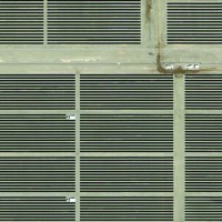
Manning guesses these are solar farms. Photo: Google Earth
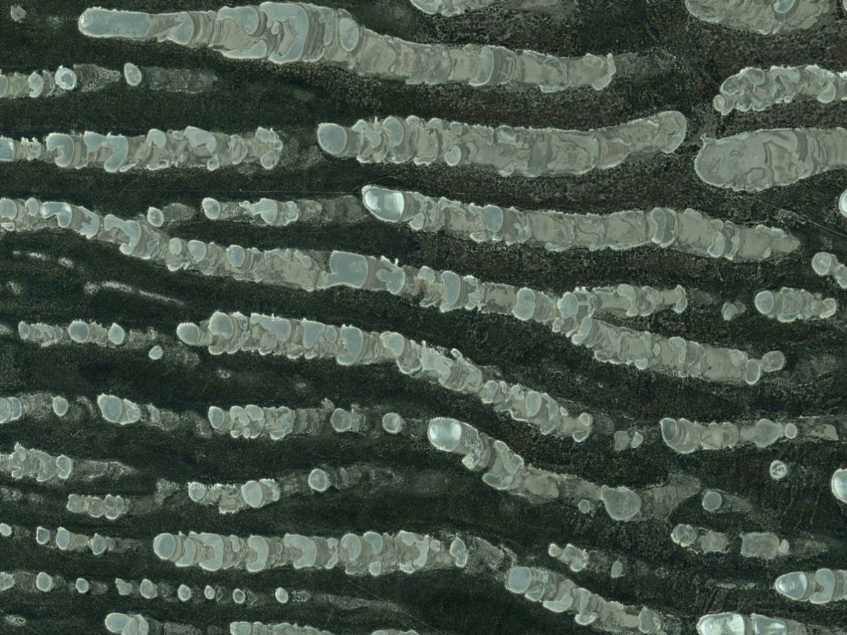
Escher farms, Ankara, Turkey. Photo: Google Earth
Villarino, Buenos Aires, Argentina. Photo: Google Earth
Ashoro-Gun, Hokkaido, Japan. Photo: Google Earth
Iran. Photo: Google Earth
Iran. Photo: Google Earth
Austbo, Norway. Photo: Google Earth
Iran. Photo: Google Earth
Kau Nature Reserve Conservation Reserve, Wittenoom Hills WA, Australia. Photo: Google Earth
Castro Marim, Portugal. Photo: Google Earth
Huelva, Spain. Photo: Google Earth
Huelva, Spain. Photo: Google Earth
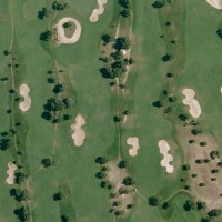
Quinta da Ria Golf Course, Algarve, Portugal. Photo: Google Earth
Santa Cruz, Argentina. Photo: Google Earth
Loncopué, Neuquén, Argentina. Photo: Google Earth
Portimão, Portugal. Photo: Google Earth
See the rest of Manning’s collected images on her Tumblr, Earth Patterns. Photo: Google Earth
SIMILAR GALLERIES

9 of the World’s Most Outrageously Expensive Headphones
Incredible Historical Photos From One of the World’s Best Museums
400 Years of Beautiful, Historical, and Powerful Globes

Use Science and Tech to Build the Ultimate Automated Garden

See How Cadbury Hatches 350 Million Goo-Filled Eggs a Year

Could a Hotel Bring Back Los Angeles’ Theater Row?


Designer Lauren Manning’s documents some of the most breathtaking swatches of the earth’s surface on her Tumblr, Earth Patterns. Here, an area she dubbed the Sequin farms, in Al Jawf, Saudia Arabia. Photo: Google Earth
Manning guesses these are solar farms. Photo: Google Earth

Escher farms, Ankara, Turkey. Photo: Google Earth

Villarino, Buenos Aires, Argentina. Photo: Google Earth

Ashoro-Gun, Hokkaido, Japan. Photo: Google Earth

Iran. Photo: Google Earth

Iran. Photo: Google Earth

Austbo, Norway. Photo: Google Earth

Iran. Photo: Google Earth
Kau Nature Reserve Conservation Reserve, Wittenoom Hills WA, Australia. Photo: Google Earth

Castro Marim, Portugal. Photo: Google Earth

Huelva, Spain. Photo: Google Earth

Huelva, Spain. Photo: Google Earth

Quinta da Ria Golf Course, Algarve, Portugal. Photo: Google Earth

Santa Cruz, Argentina. Photo: Google Earth

Loncopué, Neuquén, Argentina. Photo: Google Earth

Portimão, Portugal. Photo: Google Earth

See the rest of Manning’s collected images on her Tumblr, Earth Patterns. Photo: Google Earth
In the early days of photography, getting an aerial shot of a landscape meant attaching a camera, with a timer, to a balloon. That’s no longer necessary. These days, a bird’s eye view of the entire world is available, free of charge, through Google Earth’s satellite images. It’s a seemingly bottomless well of content that’s practically spawned a new art movement: Google Earth images have already exhibited at The Metropolitan Museum of Art, and inspired a designer to launch a line of bespoke, topographical carpets.
One such body of work is Lauren Manning’s Tumblr, Earth Patterns, where she documents some of the most breathtaking swatches of the earth’s surface. “Anytime I’d use Google Maps functionally—looking up where something was or how to get somewhere—I’d end up spending much longer than I’d intended just looking around at how amazing everything looks from above,†Manning says of her passion project. (She works for digital agency Code and Theory by day.)

Texas Gulf Potash Pond in Monticello, Utah.  Google Earth
Manning says she’s taken a couple hundred screen grabs—all on her iPad, where the retina display allows for big, clear images—and posted about 100 of those to Earth Patterns. The diversity in texture is stunning: some shots look like needlepoint, others look like Rothkos. In the deserts, the foliage and the housing are in plain sight, like dollhouse replicas of day-to-day life. And other shots—like the electric blue Texas Gulf Potash Pond in Monticello, Utah—look almost supernatural.
Manning says she would like to someday offer the screenshots as prints or postcards, but for the time being, she’ll continue to collate images on Earth Patterns.
Article source: http://www.wired.com/2014/06/19-breathtaking-patterns-found-on-earths-surface-using-google-earth/